DSWD Privacy Policy
This privacy notice discloses the privacy practices for (https://www.dswd.gov.ph). This privacy notice applies solely to information collected by this website in compliance with the Data Privacy Act of 2012.
- Privacy Notice For Processing Inquiries And Requests
Individuals will be provided a Personal Information Collection Statement in an appropriate format and manner whenever personal data is collected (i.e. in the manual form or web page that collects personal data, or in a notice posted at the reception area of NPC events where participants’ personal data is collected through attendance sheets).
The following personal information may be collected, manually or electronically, upon submission of inquiries or requests:
- Name
- E-Mail Address
- Contact Number
The DSWD uses Google Analytics, Twitter Widgets, PowerBI and Tableau, third-party services to render feeds, visualizations, and analyze the web traffic data for us. These services use cookies. Data generated is not shared with any other party. The following web traffic data are analyzed:
- User IP address
- The search terms used
- The pages and internal links accessed on our site
- The date and time a user visits the site
- Geolocation
- The referring site or platform, if any
- Operating system
- Web browser type
- Information Collection, Use, and Sharing
The DSWD is the sole owner of the information collected on this site. The DSWD only has access to/collect information that you voluntarily give us via the modules of this website or other direct contact from you. All of the provisions in the Data Privacy Act will be observed specifically on the management of personally identifiable information.
Information collected may be used as a basis for client response regarding services or intervention that may be provided by the DSWD. Information will not be shared with any third party outside of the Government, other than as necessary to fulfill the requested services of a client. The DSWD, however, reserves the right to request the applicants to submit the hardcopy of documentary requirements in order to verify the authenticity of the information.
Unless otherwise provided, the DSWD or any of its authorized personnel may contact the client via email or SMS in the future for the purpose of status updates with regard to the transaction/service request, changes to this privacy policy, or other information reasonably necessary to effect the social service mandate of the DSWD.
An individual has the right to ask for a copy of any personal information held by the DSWD about him or her; as well as the right to ask for corrections should any information be inaccurate or erroneous. To do so, please contact our Data Protection Officer, Atty. Justin Caesar Anthony D. Batocabe, through the following email address: dpo.ictms@dswd.gov.ph.
The DSWD takes precautions to protect information. Upon submission of sensitive information via the website, information is protected both online and offline. Wherever the Department collects sensitive information (such as passport and Birth Certificates), that information is encrypted and transmitted to the DSWD in a secure manner. This may be verified by looking for a lock icon in the address bar and looking for "https" at the beginning of the address of the web page. Only employees who need the information to perform a specific job (for example, certificate printing or customer service) are granted access to personally identifiable information. The computers/servers, where personally identifiable information is stored, are kept in a secure environment.
By using our website, you hereby consent to our Privacy Policy and agree to its terms.
- Feedback on our Privacy Notice
For suggestions with regard to this privacy notice, you may accomplish this form. (https://www.dswd.gov.ph/feedback/), email inquiry@dswd.gov.ph, or call (632) 931-8101 to 07.

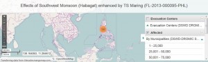 In its bid to better coordinate relief efforts of the government, international and local humanitarian agencies in times of disasters, the Department of Social Welfare and Development-Information Communications Technology Management Service (DSWD-ICTMS) developed an Online Geographic Information System or WebGIS, a map which visualizes reports on disaster-affected population and the location of evacuation centers.